We asked this before about JPL* and Sandia Labs etc. doing so little observation of Lake FUBAR.
We don’t know if the sinkhole is collapsing downward or sideways or both and huge butane caverns are nearby as well as State Highway 70.
Last night PBS aired this show on NOVA about Vikings and finding pre-Columbus settlements using space imagery. The show demonstrates how the imagery can penetrate top levels of the ground to see a certain depth underground at great accuracy, 10 inches(!).
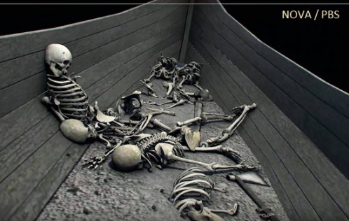
Here is the episode: http://www.pbs.org/wgbh/nova/ancient/vikings-unearthed.html
So why isn’t anyone at LSU or U of Alabama or other science lab utilizing info that is already available to check out Lake FUBAR?? And can’t the parties that caused the sinkhole foot the bill? In the documentary U of Alabama was the place that did all the fancy imagery examination. They aren’t so far away from Bayou Corne.
LINK – http://youtu.be/uGcC1vUjPXI
Short video with still images – Elusive Viking Site Spotted From Space – Newfoundland, Canada
 Laws would stall agencies’ ability to file lawsuits
